Ελληνικά
Route from Hora to Falatados through Exomvourgo
From the capital of Tinos (Hora) to Falatados through Exomvourgo
Distance: approximately 8 km
Hours: approximately 4 plus 1 to climb up and down Exomvourgo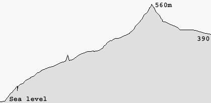
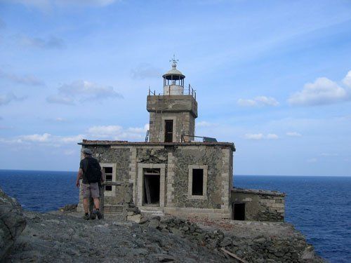
Leaving Hora
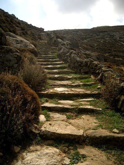
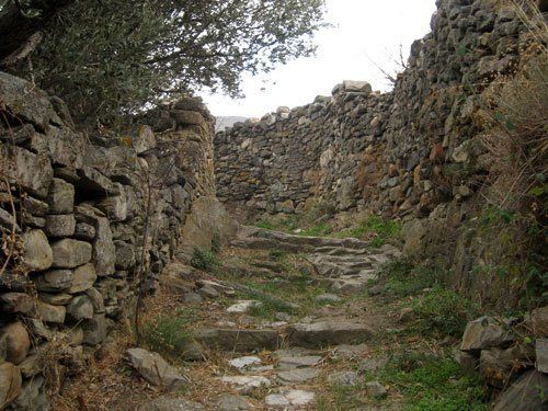
Start your route from the round marble square at the end of Panagia Evangelistrias street. Start going up the big street until you find an alley on the left (100 m) with a one-way sign. Turn left and pass by the tavern named Petros on a small square. Continue straight ahead, passing under a grapevine of another tavern. At the next intersection go straight again, following the uphill alley until you find a clear with a house in front of you (150 m). Turn right and immediately left onto the next alley. Go right and left again at the public fountain and then straight ahead, following the main path to the North. At the main intersection (160 m) with a wide paved road coming from the right, go straight, following the course of the old path.
The path runs through a stately neighbourhood of the capital of Tinos. There are beautiful neoclassical houses in big gardens enclosed by high stone walls. You will go up the stairs and you will find a small archaeological site with ruins of houses of the Classical Era on the right. Our route follows the ancient city limits. As you go up, you will see parts of the defensive walls. An old rusty door on the right bears the symbol of Jesuit Monks. A Venetian Lion and a Dragon decorate the Arch.
Following Vari (ancient path) until the plateau of Kira Xeni
Next, you will reach a road (290 m) coming from the right again. Walk straight up, as shows the hiker in the blue sign. After 155 m, you will reach the ring road of Hora with the characteristic Stop sign. Cross the road and follow the uphill path. The path has been repaved as far as the houses and the ancient paving stones have been used in part. As you walk up the path, you will see parts of the ancient masonry, mostly on the right side, scant evidence of the former location of the ancient castle.
After 530 m, you will find a road coming from the right. This is where the defensive wall of the ancient city ends.
If you turn right and look to your left, after 10 m, you will see an ancient quarry where people would dig out rocks to build the castle. Further down (30 m) on the right, there is also a big part of the wall which is still standing.
To continue, return to the main path. A smooth, uphill part of the route comes next. This part runs parallel to the valley on the right where there are some beautiful dovecotes. There is also an ancient aqueduct (lost in the vegetation and partially buried, built by the Athenian tyrant Peisistratus in 549 BC) which supplied the city until 1934 and still supplies the sacred spring of Our Lady.
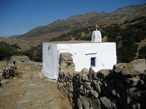
After 1 km, the path meets a dirt road coming down from the left. Go straight ahead, following the road for 50 m and then, at the point where the road turns right, go straight onto the old path. Cross the slope to get to the plateau of Kira Xeni (440 m) with the old Byzantine inn and the chapel. The inn has been unsuccessfully preserved and restored and it is unlikely that it is used today. It used to be a place to stop for the residents of the North, who would finally arrive at their destination, the capital of Tinos, after a long journey. The chapel has a beautiful marble relief plaque depicting the Virgin Mary with Jesus and Saint Xeni.
Plateau of Kira Xeni-Exomvourgo
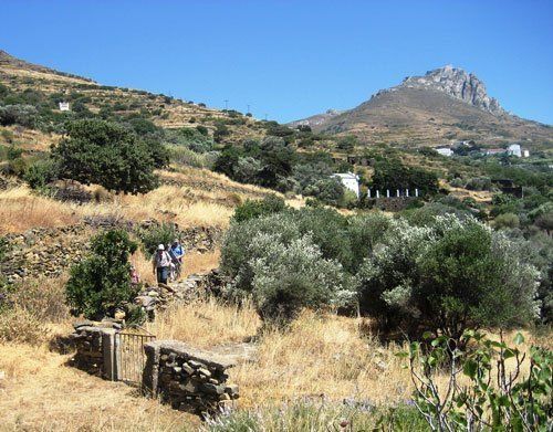
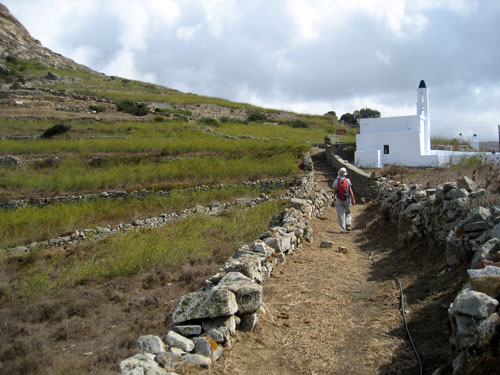
Walking past the chapel on the left, continue onto the main path, always with the impressive granite mass of Exomvourgo in front of you. Ignore a path coming up from the left. At a fork after 850 m, turn left and cross a small bridge over a fountain with a laundry room. The stone path meets the main road to Pyrgos after 370 m.
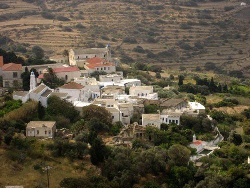
At the asphalt road, turn left and immediately right, before a big industrial building (dairy), and go down the stairs which take you back to the old path. Walk up the path to the ridge with the windmills on the left (70 m). Go straight down (do not follow the path on the right). After 20 m, make a right turn onto the path towards Exomvourgo. Look to your left for the verdant plain of Komi and diagonally to the left for the villages of Skalados, Krokos and Loutra. Right below, you can see the village of Xinara, seat of the Municipality of Exomvourgo. At the next intersection (565 m), where a path comes up from the left, go straight ahead in order to find a path again after 40 m, behind a chapel, where you turn left.
Further down, after 100 m, on your left and right there is an archaeological site where foundations of a settlement of the geometrical era (9th century BC) and parts of a defensive wall of the classical era (5th century BC) lay. When you find a path on the right, go straight ahead and uphill, between the low walls. The path crosses the eastern slope of the rock and on your left you can now see parts of the Venetian castle of Exomvourgo.
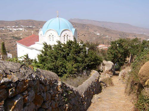
When you reach the northern part of the rock, you will find a dirt road (360 m) where you turn right. Saint Minas chapel is behind you. The Catholic Sacred Heart Monastery (“Ieras Kardias” in Greek), seat of the Catholic Archbishop of Tinos, in front of you. A memorial brings to mind the Catholic victims of the wars between 1912 and 1950.
The castle bears the name of Saint Helen, whereas the fortified town below is called Exomvourgo.
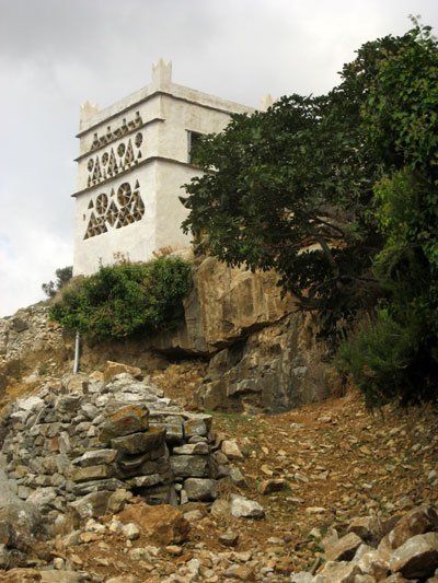
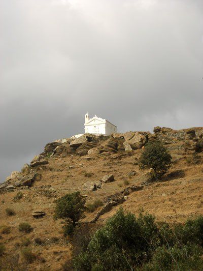
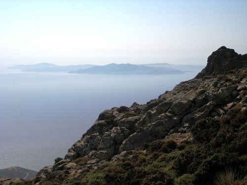
To climb up Exomvourgo, go past the sign “Towards Saint Helen’s Castle” on the right, leaving the monastery courtyard on your right behind you. Follow the stone path to the top where there is a cross (altitude 560 m), a rare thing for Greek mountains (probably because it is in a Catholic area or because this is the island of the Virgin Mary). The villages of Volax and Koumaros are in the north-east. The villages of Falatados, Steni, Messi are in the east. Also, the villages of Tzados, Karia, Mountados, Sberados are in the south-east. Right below there is the village of Tripotamos.
The capital of Tinos (Hora) is in the south and the villages of Ktikados, and Hatzirados are in the south-west. And the villages of Kambos and Tarambados are in the west and the village of Komi with the homonymous plain is in the north. Also, the mountain to the right of Falatados is Mount Tsiknias (altitude 730 m) and the second biggest mountain is Mount Kechros which is on the right (probably named after the millet, “kechri” in Greek). The Kechrovouni Monastery is on Mount Kechros. In the west, there is another big mountain called Polemou Kambos (which means “the flatland of war”).
Exomvourgo – Falatados
As you leave the east gate of the Sacred Heart Monastery courtyard, after 50 m, you will find a small asphalt road where you turn left. After 340 m, at the end of the downhill road, you will see a small stone cell on the left. Two paths to the left start right on this spot. The first one to the left runs towards Koumaros and the second one towards Falatados. Turn left towards Falatados, following the hiker on the blue sign.
After 365 m, you will reach the main road to Koumaros. Cross it diagonally to the left to find a small dirt road leading to Falatados. Next, you will see a chapel on the left (150 m). On the outskirts of Falatados you will find a road again (965 m) where you will go left.
Turn right before the church with the marble relief plaque depicting a double-headed eagle. At the parking lot, after 110 m, turn right again. Follow one of the narrow alleys running through the village. Soon, you will reach the main square with a church and two cafés. Make a right turn before you reach the square. Follow a wide downhill road with stairs in the middle in order to go to the bus stop and the tavern named Lefkes.