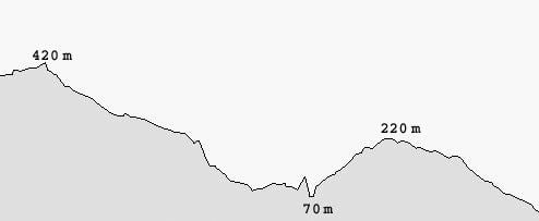
Falatados – Kolimbithra
Distance: approximately 10 km
Hours: approximately 4 hrs
Falatados – Volax
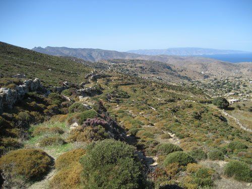
At the parking lot, go up the wide path with the stairs in the middle towards the centre of the village. Go past the school on the left and the tavern named Katoi on the right. On the right you will find the entrance to the small village square and a vertical alley where you turn left (turn right to go to the church and the village cafés). Go through the Arch and at the fork turn right (170 m from the parking lot). Keep to the right, going past a cream coloured house with blue windows on the right, until you see a church with a four-level belfry. The alley leads to a parking lot (110 m) and a wide road which you follow to the left. Soon you will find a small asphalt road where you go left again. At the church there is a marble relief plaque depicting a double-headed eagle. At the second dirt road on the right (155 m from the church) turn towards Exomvourgo. Go past a double church on the right. The view of both sides of the island is wonderful. The mountains in the background on the right are located in Andros. On the left you will find short oak trees which are what is left up here of the primeval vegetation of the island. After 370 m, you will find a field on the right which, unfortunately, has been transformed into a car graveyard. Right after the field, on the right, there is a downhill path running towards Volax. Turn right and after 30 m pass through the small door on the right to enter a fenced downhill field. Follow the small wall on the right until the pen (235 m). Walk through or around the fenced area. Keep going downhill parallel to the low wall on the right towards the chain-link fence which you cross over. Soon the path closes due to vegetation. Turn right (cross over the low wall) and walk parallel to the old path, having the low wall on your left now.
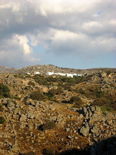
After 85 m, at a cluster of large rocks, cross over the wall again on the left and follow the path which is more visible now. The path, which has lush vegetation for about 100 more metres, smoothly traverses the slope in a northwest direction (330°). Right after a spring on the left (300 m) turn right and downhill at the intersection in order to reach an asphalt road towards Volax, after 120 m. Turn right and after 375 m, at the end of the road, you arrive at the entrance to the village with the beautiful shady square and the traditional cuisine tavern named Volax.
Volax – Chapel of Saint Veneranda – Agapi
From tavern Volax, keep going downhill into the village until you find a small square. Cross it straight ahead, passing by a marble relief plaque on the right with a dolphin to the left. In front of you, you will see a traditional house with a shed below it and stairs to the roof. Turn right and immediately left and you will reach the village church. Pass by the church to the right, walk out of the village onto a paved road (185 m). At the fork, turn left onto a dirt road. After 190 m, look to the right to find a set of carved stairs, which marks the entrance to an old path, where you turn right.
The road to the left follows the course of a path dating back to the Byzantine Era (before 1453), which unfortunately has been destroyed by residents of the area with the connivance of local authorities.
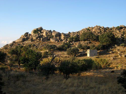
Go past a small cell on the right and at the fork (85 m) with the small tree (oak tree) turn left into a path between low walls. On the horizon you can see a chapel and the mountains of Andros. After 240 m, the path ends at a low wall (on your left there are three stone huts) which you cross over to walk into a large fenced field. Keep to the left following a row of big rocks and the low wall right after it. With an azimuth of 310°, follow the goat path towards a characteristic corner of the field. On the slope just opposite there are three chapels and on the right you can see the village of Sklavochori.
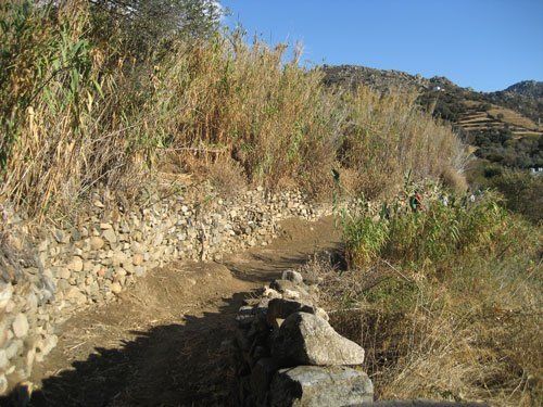
At the corner of the field (140 m), cross over the low wall and turn immediately right following the goat path again, having the low wall on your right this time. Soon you will find another low wall in front of you (80 m) to the left of a big round rock. Cross over the wall and go downhill towards a wall which hedges some almond trees in (70 m). Turn right and follow a small path between rocks having the wall on your left. Soon you will see a village in front of you (named Agapi) which is where you are headed. With an azimuth of 330° and the village in front of you, keep going downhill towards another low wall with a chain-link fence (150 m). Cross over the wall into a rocky slope with lush undergrowth. The path is not visible at first, but after 20 m, if you look down to the left, you will see the roof of a Catholic chapel, the chapel of Saint Veneranda, which is where you are headed.
To continue, go down the goat path towards a threshing field, above a small oak forest to the left. Follow a ruined wall on the right and at the end of it (140 m from the chapel) follow the downhill path towards the old deserted flower beds. After 45 m, you will find a low fence which you cross over. Keep going downhill following the wall on the right until the v-shaped oak tree where you go left. Follow the path until you see a dovecote roof (100 m). Pass by the dovecote and turn right. Follow the low wall over the valley until the small cells after 110 m. Go past the entrance of the field and turn immediately left onto a road towards the riverbed. Cross it and walk down along the river on the right. After 30 m, you will find a path coming down from the left (60 m from the small cells) where you turn right. There are planted gardens and flower beds until a dovecote (330 m) and a bridge across the river. Cross the bridge and turn immediately left. At the fork after 320 m, turn right and you will soon find a small road on the left which you follow until the village of Agapi (175 m).
Follow the main alley of the village in order to reach the village square, which has a playground and a laundry room, after 400 m.
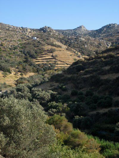
Agapi – Kolimbithra
Leaving the playground behind you, go up the alley to the left of the small plane tree and after 65 m, you will reach the entrance to the village with the parking lot. Go across and up the stairs of the path under the surface-mounted clock. Follow the rocky path on the right towards the ruins and at the fork turn left. Go up the stairs so as to reach the asphalt road after 120 m. Follow the road to the left for 335 m in order to find a path, close to a blue gate, which goes diagonally up the slope towards the col (375 m) where there is a dirt road. Turn right onto the dirt road. Ignore a dirt road on your left and after 410 m, you will reach an intersection where you go left. After 180 m, there are two paths on the right and you take the second one (there is a sign with a light blue dot). After 370 m, you will reach the dirt road again and you will go right. Follow the road for 2 km and you will reach the village of Kolimbithra where there are two taverns; one of them is further down on the small beach and the tavern of Victoria with its splendid cuisine is a bit further up at “Kolimbithra” rooms to let.


 Ελληνικά