From the capital of Tinos (Hora) to Arnados – circular route
Distance: approximately 13 km
Hours: approximately 6
.
.
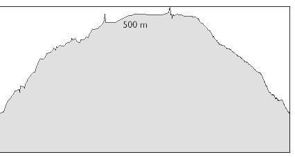
.
The route starts at the square with the two palm trees on the coastal road of Hora. Heading southeast, go past Saint Chrysostom’ s Church on the left and after 300 m, turn left, passing by Hotel Aeolos.
Aeolos – Holy Trinity Monastery at Girla
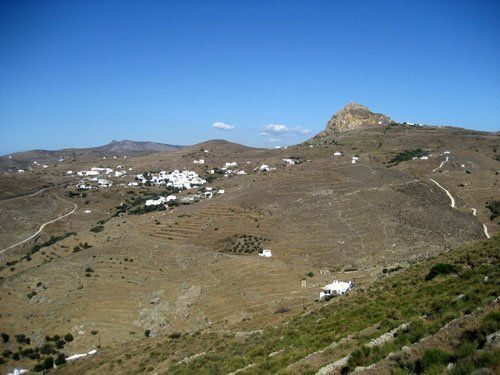
Follow the coastal road to the east towards Saint Fokas. Go past two vertical streets on the left, one before the tavern named Galaxias, the other one before the tavern named Yaloussa. You can see Vriokastro on the horizon, a protected area of a Neolithic settlement. The islands just opposite are Mykonos to the left, Delos and Rinia to the right. After 890 m, turn left onto a small cemented road, after a characteristic stone wall, before a plain two-storey building. The road runs in front of vineyards, an olive grove and a chapel on the right, which is one of the island’s 2000 chapels. The mountain in the background is Mount Kechros. On the left the granite massif of Exomvourgo stands out.
After 940 m, you will reach the main road to Porto. Turn left for 35 m and then right, following a small road shaded by cypress trees and oleanders. At 380 m you will reach the parking lot of the Monastery. Cross the small bridge and enter the cool courtyard of the Monastery. At the gate there is a mural of Holy Trinity with a rare depiction of a triangular halo (the Monastery dates back to 1000 AD approximately). Look for the guard; he will be glad to show you the hidden school and the beautiful collection of lintels, typical of Tinian marble sculpture.
Holy Trinity Monastery – Triandaros
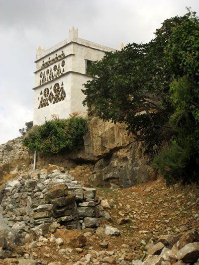
As you exit the Monastery, turn right, following a path which runs parallel to the outer wall of the Monastery. After a laundry room, at 80 m, turn left onto a small dirt road. Then, continue onto a cemented road, passing by a dovecote on the left. After 210 m, right where the road swings to the right, go left and uphill onto a path next to an electric meter. Ignore a path coming from the right and follow the ledge which is parallel to the parcel. Turn right (260 m) onto a clear path, passing by a small stone cell with rounded walls. The path becomes wider and continues uphill until an intersection (300 m) where you go left and then at the next intersection (150 m) left again. Turn right onto the cemented road, passing by a blue gate on the right. After 30 m, turn left onto a small weedy road before a stone wall. When you reach the lowest spot and the railing gate (250 m), turn right onto the old parallel path which traverses the valley.
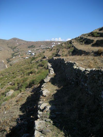
Make right onto a distinctive right turn of the path (410 m), walking parallel to the valley on your left, and ignore a cobbled alley with stairs from the right. At the next verdant intersection with fig trees and Spanish brooms, continue straight onto the traces of the old path. Low vegetation and ruined parts of the path will make your route a bit more difficult. At 250 m, the path becomes uphill again, running by stone cells on the left. Soon, it becomes downhill again towards the bed of the valley. At an intersection opposite a mulberry tree (240 m), continue straight ahead, ignoring the path which comes down from the right. At the ruined cell (65 m) go right and uphill.
Triandaros – Dio Choria
Go up the steep stairs until Saints Anargiri chapel on the right, which has a beautiful, cool courtyard. Go all the way up the stairs, past the chapel and turn left at the cemented road. Soon, you will find a spring of water (not potable) on the right. Continue onto the road until you reach the spot where the path becomes uphill and turn right. Follow it to get to the main road of Triandaros (380 m from the chapel).
Turn right and keep walking until you find the tavern named Lefkes (at 200 m) with traditional cuisine (open from April to October). A beautiful stone fountain (drinking water) nearby has replaced the two enormous poplars from which the tavern took its name. The machinery of an old olive mill also decorates the place.
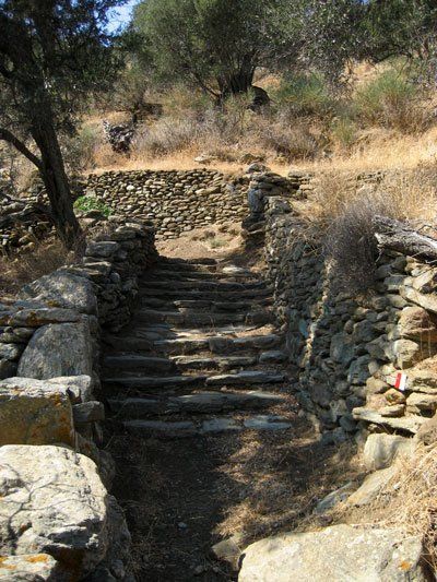
To continue your route, go up the wide stairs behind the tavern, to the left of the fountain. At the first intersection, go right and uphill in order to walk through the upper part of the village (on the left there are some characteristic stairs under a balcony). At the house with the lintels just opposite, turn right passing by a wooden telecommunications pillar. Turn left into an old, covered alley and go up the stairs until you reach the paved street of the village, where you go right. Go past a number of parking lots on the left and follow this street for another 120 m. After a chapel, turn left onto an alley with stairs (340 m from the tavern). Follow the old path for 120 m and turn left. Go through the bulldozed path (125 m) so that you reach the main road after a few meters. Turn left, going past the road sign of Dio Choria, until you reach one of the many fountains on the way.
At the fountain with the plane tree (there is drinking water here too), go uphill towards the village square with the wide stairs. Go past a telephone booth and a playground. There is a small café at the cool village square and two more fountains. The baptism of Jesus in Jordan River is depicted on one of them.
Dio Choria – Arnados – Chora
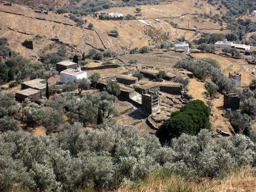
At the village square go up the stairs to left of the spring and at the first intersection (10 m) turn left and go up the stairs. Follow the partly covered alley and you will soon be outside the village (255 m). At the end of the alley there is a small path which leads to a set of stairs on the right. Go up the stairs until you find a road that you follow to the left. After 235 m, the road starts going uphill and very soon it goes downhill again (210 m). Keep going until an intersection with a road coming up (155 m). Turn right and follow the road for 10-20 m until you have the chance to go down the path on the left which runs parallel to the road. Follow it downhill for 30 m and opposite the dovecote turn right onto a path which starts with a set of large concrete steps. On your right you will find a spring of drinking water. Follow the verdant path passing by a long and narrow cistern. On the outskirts of Arnados (270 m) the path splits and you follow it to the right. Go past two chapels (100 m) and at the next fork (90 m) go left and downhill to get to a small square with a beautiful marble fountain. Follow the alley on the right until the fork (85 m) and go right again until the village square with the Church of the Ascension on the left which dates back to 1908 (85 m again). Next, go up the stairs and keep to the right. Soon you will arrive at a parking lot. Go downhill until the main road (270 m) and turn right. Soon you will reach the entrance to the Monastery of Kechrovouni (360 m) which is worth a visit.
To continue your route, follow the path with the white stairs opposite the entrance towards a chapel. After a while, you will reach a road (125 m) which you cross, going downhill to the left. After 55 m, turn right onto an old path before the first houses. At the next intersection (150 m) turn left (careful not to go right and downhill). Pass below some houses and after 170 m, you will find a path on the left. Go right and downhill towards a dovecote. At the next intersection (110 m) go left (a bit uphill). After 10 m, you will find a blue wooden door on the right. Open the door to go down to the church courtyard. Then, go straight down the road coming from the left (70 m), leading to an old path which you follow. After 230 m, turn right at the junction with a path coming from the left. After a while you will reach a road where you turn left (310 m). After the house with the pool, before the intersection, you go right following a path which runs parallel to the fence. Cross the road (120 m) you find, turn right and immediately left onto a cemented side road after 20 m. Go past the church on the right and keep going downhill. At the first intersection (300 m) with a characteristic storage room on the left, turn right onto an old path with wide stairs. After 560 m, you will reach a dirt road where you go right. At the next intersection (180 m) with a cemented road, go straight downhill. After 410 m, at the entrance of a plot of land with an old mill, go right following the course of the old path. Cross the road (430 m) and go straight downhill. Soon you will find a big intersection (470 m) with a gas station. Turn right to go downtown.


 Ελληνικά