Route from Hora to Kionia
From the capital of Tinos (Hora) to Kionia through Ktikados (circular route)
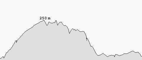
Distance: approximately 9 km
Hours: approximately 4
Leaving Hora
Start your route from the round marble square at the end of Panagias Evangelistrias street. Start going up the big street until you find an alley on the left (100 m) with a one-way sign. Turn left and pass by the tavern named Petros on a small square. Continue straight ahead, passing under a grapevine of another tavern. At the next intersection go straight again, following the uphill alley until you find a clear with a house in front of you (150 m). Turn right and immediately left onto the next alley. Go right and left again at the public fountain and then straight ahead, following the main path to the North. At the main intersection (160 m) with a wide paved road coming from the right, go straight, following the course of the old path.
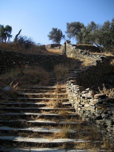
The path runs through a stately neighbourhood of the capital of Tinos. There are beautiful neoclassical houses in big gardens enclosed by high stone walls. You will go up the stairs. You will find a small archaeological site with ruins of houses of the Classical Era on the right. Our route follows the ancient city limits. As you go up, you will see parts of the defensive walls. An old rusty door on the right bears the symbol of Jesuit Monks. A Venetian Lion and a Dragon decorate the Arch.
Following Vari (ancient path) until the plateau of Kira Xeni
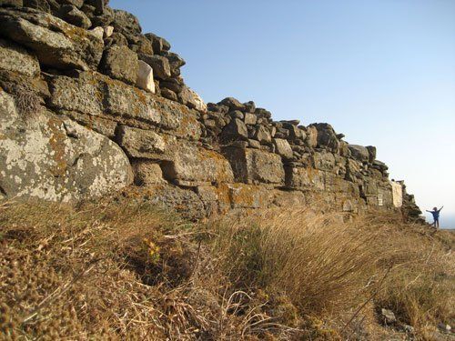
Next, you will reach a road (290 m) coming from the right again. Walk straight up, as shows the hiker in the blue sign. After 155 m, you will reach the circumferential road of Hora with the characteristic Stop sign. Cross the road and follow the uphill path. The path has been repaved as far as the houses and the ancient paving stones have been used in part. As you walk up the path, you will see parts of the ancient masonry, mostly on the right side, scant evidence of the former location of the ancient castle.
After 530 m, you will find a road coming from the right. This is where the defensive wall of the ancient city ends.
If you turn right and look to your left, after 10 m, you will see an ancient quarry where people would dig out rocks to build the castle. Further down (30 m) on the right, there is also a big part of the wall which is still standing.
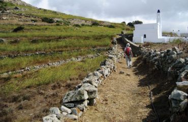
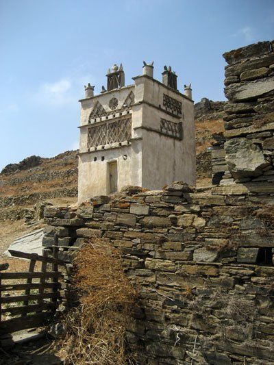
To continue, return to the main path. A smooth, uphill part of the route comes next. This part runs parallel to the valley on the right where there are some beautiful dovecotes. There is also an ancient aqueduct (lost in the vegetation and partially buried, built by the Athenian tyrant Peisistratus in 549 BC) which supplied the city until 1934 and still supplies the sacred spring of Our Lady.
After 1 km, the path meets a dirt road coming down from the left. Go straight ahead, following the road for 50 m and then, at the point where the road turns right, go straight onto the old path. Cross the slope to get to the plateau of Kira Xeni (440 m) with the old Byzantine inn and the chapel. The inn has been unsuccessfully preserved and restored and it is unlikely that it is used today. It used to be a place to stop for the residents of the North, who would finally arrive at their destination, the capital of Tinos, after a long journey. The chapel has a beautiful marble relief plaque depicting the Virgin Mary with Jesus and Saint Xeni.
Plateau of Kira Xeni – Ktikados
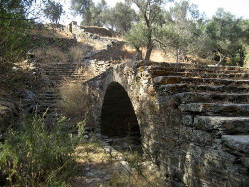
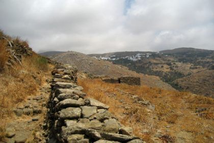
Go past the chapel on your right and down a path with stairs towards the valley. On the opposite slope you can see the ruins of the old village of Ktikados which was abandoned due to an epidemic in the 17th century. In the depths of the valley, you will come to a bridge (230 m), probably over 250 years old, which was built with great love and care. Continue onto the uphill path and after 170 m, you will find a path coming down from the right.
Ignore this path and continue straight ahead to the next fork (at 90 m) where you go left and downhill. Soon you will reach the outskirts of Ktikados. You will see the old Primary School (now without students) in front of you (200 m), one of the few buildings of the village with a tiled roof. On the right there is a deserted and almost completely destroyed house with a beautiful decoration on the internal arch, typical of Tinian Architecture.
Continue your route through the narrow alleys of the village. On your left (60 m) you will find the entrance (with a relief decoration of Saint George killing the Dragon) to the courtyard of one of the two big churches of the village.
Further down the route (100 m) to the left, you will find the tavern named Drosia with its amazing cuisine. After 40 m, you will reach the village square with a laundry room and a fountain (drinking water). The café-bistro named Agnanti above the square with its delicious tasters invites to have a seat.
Ktikados – Kionia
To continue your route, go past the village square, leaving the fountain on your right behind you. Then follow the only road running through the lower part of the village. Keep to the left and after a while (155 m) you will be outside the village, at a small water trough on the right. There are capers on your right along the way; a characteristic feature. In the depths of the verdant valley, at 530 m, the rough and wild landscape of the surrounding mountains is interrupted by a fountain (non-potable water). The path goes uphill for a while and then smoothly traverses the west side of the valley. When you reach the spot where there is a path coming from the right (560 m) from the nearby village of Hatzirados, continue straight ahead and downhill.
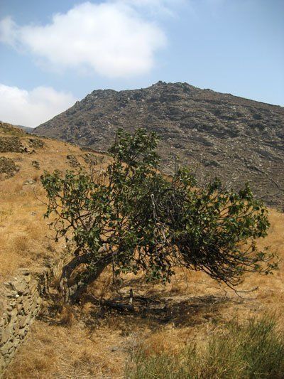
Ignore several paths (at 100 m) on the left and right and continue onto the downhill central path, past some stone benches. The path ends at a cemented road (which you go down). You will see the entrance to a hotel on the left and one of the rare hiking signs of the island on the right.
Kionia – Hora (capital of the island)
Go downhill for 225 m until you find a path on the left, opposite a telephone booth. Turn left and after 80 m you will reach a riverbed which functions as a road as well. Cross it diagonally to the right and go up onto the continuation of the path. Turn right at the fork. Walk above the settlement of Kionia. Soon you will see the archaeological site of the temple of Poseidon and Amphitrite on the right. After 350 m, the path ends at a small road. Go right and pass under the big tamarisk. Soon you will reach the main road of Hora-Kionia where you turn left. Go past Saint Mark’s chapel (490 m). At the low stone wall next to the road, parts of the ancient road (big rectangular chunks of marble) are used as small tables.
When you reach the next wide section of the road (240 m), to the right of which a parking lot has been created, look to the left to see another big section of the ancient road (half buried) next to an archaeological site (house foundations). After 210 m, turn right at the stairs with the sign “No dogs allowed”. You’ll soon reach the small beach of Stavros with the homonymous chapel, where the ancient port was situated (there are characteristic parts of the pier and the columns to which ships used to be tied until the 18th century). A small café invites to have a seat and marvel at the sunset.
In order to go back to Hora, continue onto the main road to the next intersection (225 m) with the ring road of Tinos. There you turn left for 540 m and then right into a newly built neighborhood of Hora. At the end of the new road (360 m), you will reach a round square with a playground and an old mill. Turn left and then left again onto the second alley. After 110 m, you will see some stairs. You go down until the cemented bed of another river (65 m).
Turn right and immediately left, passing by a small blue bridge. On your right you will see one of the oldest houses of the island with Venetian chimneys. After the bridge, turn right and immediately left, going up the wide stairs. After a while you find the small road you went up earlier at the beginning of the route (55 m). Turn right and soon you will reach the main street of Hora, i.e. Panagias Evangelistrias street (200 m).


 Ελληνικά